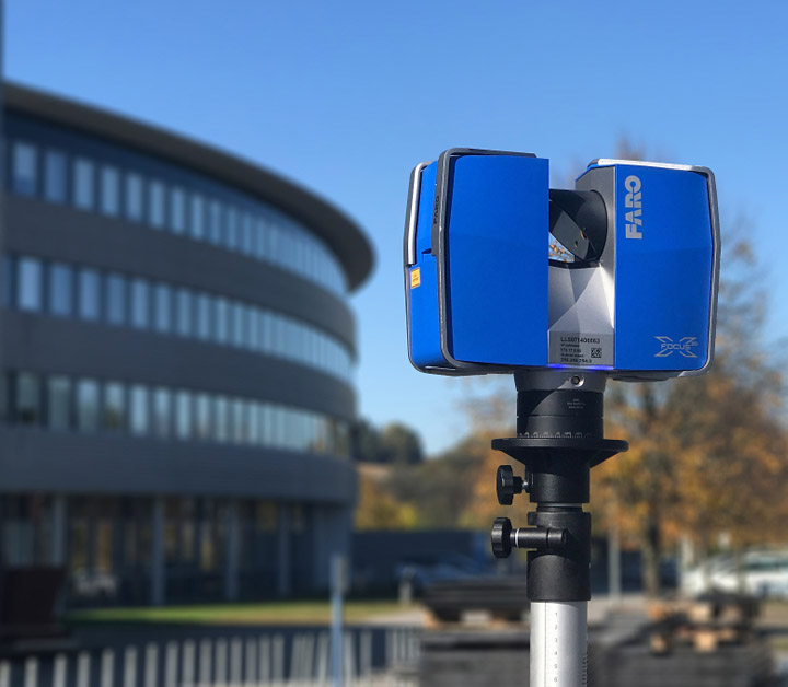
CAD and 3D Scan to CAD
At Tecsava, we offer professional CAD and 3D Scan to CAD services that seamlessly integrate advanced scanning technology with precisecomputer-aided design ....
A globally recognized leader in cutting-edge technology solutions and services, proudly ISO 9001:2015 certified. Based in India, Tecsava is committed to delivering innovative, high-quality solutions that drive efficiency and value for clients around the world. We specialize in a wide range of services, including Floor Plan Marketing, CAD and 3D Scan to CAD, GIS and Utility Mapping, 3D Scan to 3D Revit Model, 3D Visualization, and GIS & Utility services.
At Tecsava, we understand the importance of transforming complex data into actionable insights. With a dedicated team of experienced professionals and state-of-the-art technology, we offer a wide range of services designed to meet the diverse needs of industries such as architecture, engineering, construction, urban planning, and more.
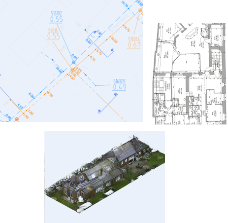
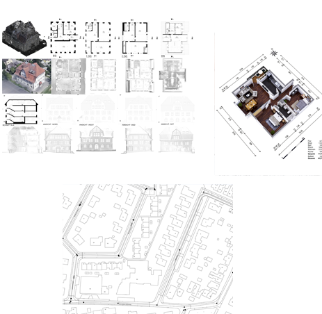
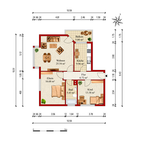
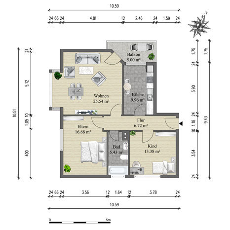
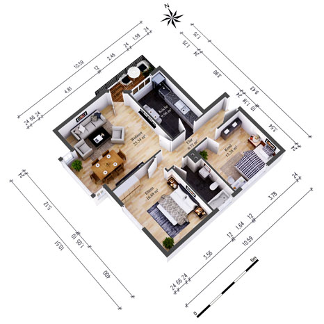
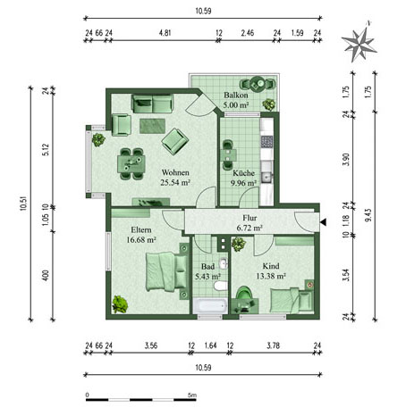
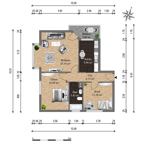
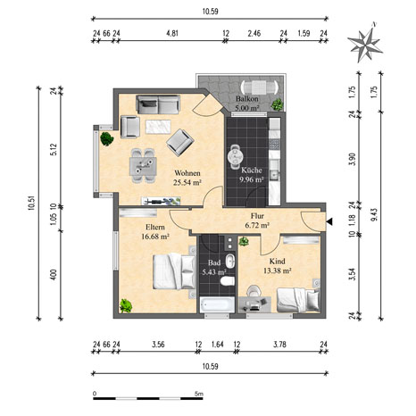
As the leading provider in vectorization for high-precision digital plans, we excel in converting intricate data into accurate, scalable digital formats. Our advanced technology guarantees exceptional accuracy, facilitating the smooth execution of design projects. With extensive experience, we establish the benchmark for quality and precision in digital plan vectorization, offering clients dependable, detailed, and precise representations that contribute to successful results.
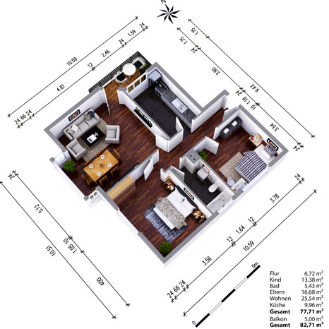
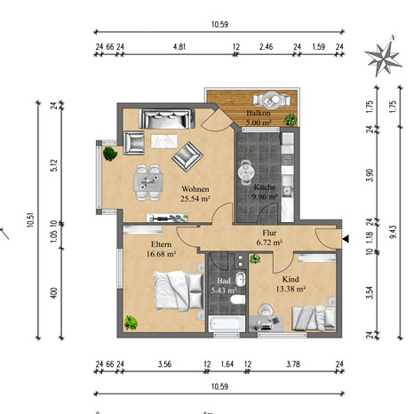
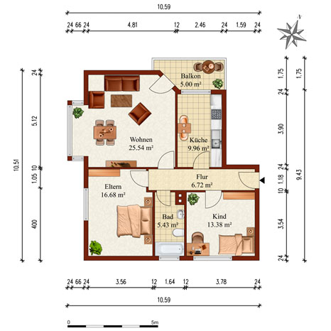
Specializing in high-precision digital plan vectorization, we convert complex data to accurate, scalable formats using advanced technology for project success. Our expertise includes vectorizing network and survey data for residential and commercial buildings, creating precise 2D CAD and impactful 3D models. Services range from CAD plans to LiDAR mapping, simplifying CAD digitization and enhancing digital mapping and design accuracy. Additionally, we offer GIS integration for infrastructure mapping, power lines, and telecom cables. Our solutions include archiving, updating CAD files, and custom floor plans, ensuring flawless digital blueprints and efficient storage.
At Tecsava, we offer professional CAD and 3D Scan to CAD services that seamlessly integrate advanced scanning technology with precisecomputer-aided design ....
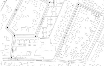
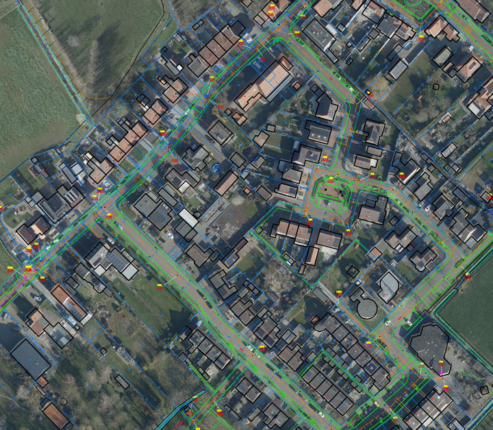
Tecsava is at the forefront of providing comprehensive GIS (Geographic Information System) and Utility Mapping services tailored to the specific needs of industries....
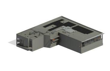
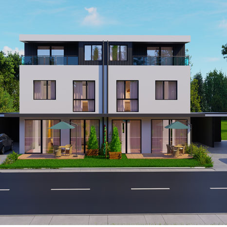
At Tecsava, we offer cutting-edge 3D Scan to 3D Revit Model services designed to transform your construction, architecture, and engineering projects into high-quality, accurate....